
The flood that changed Hyderabad forever
Long before Hyderabad became the city as we know it today, the Musi was at the centre of its story. It was this river that shaped Hyderabad’s growth, its people, their lifestyle and its choices. But every now and then, the Musi also reminded the city of its power. What happened in 1908 was – known to people as the Great Musi Flood – a turning point that forced Hyderabad to rethink how it lived with its river.
Flooding during monsoon was a constant facet of Musi. The earliest recorded instance was in 1631, and there were around 13 major floods before 1908, including a severe one in 1678 during the reign of Abdullah Qutb Shah. Although Hyderabad had learned to live with the river’s seasonal moods, what happened in September 1908 was something the city had no point of reference for.
What happened on September 26, 1908?
It began, as most disasters do, with a slow build. The river was at normal monsoon levels on the evening of September 26. Heavy showers started later that night. By 2 a.m. on September 28 the city had the first alarm as water had backed up behind Puranapul. The river breached the city rampart on the west side around 3 a.m. By 7 a.m., the levels were rising dangerously. By 9 a.m., every bridge on the river had been overtopped.
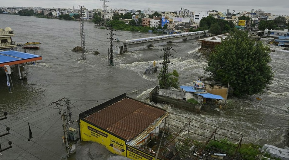
The flood peaked around 11 a.m. In 48 hours, Hyderabad had witnessed nearly 19 inches of rainfall. The river, normally around 700 feet wide between its banks, had spread across the city to around 1.2 kilometres. The water depth above the river bed varied between 38 and 45 feet.
It wasn’t the rainfall that made it so devastating; it was the fact that 221 of the 788 tanks in the Musi’s basin had been breached. The water had nowhere to go except into the city.
The extent of devastation
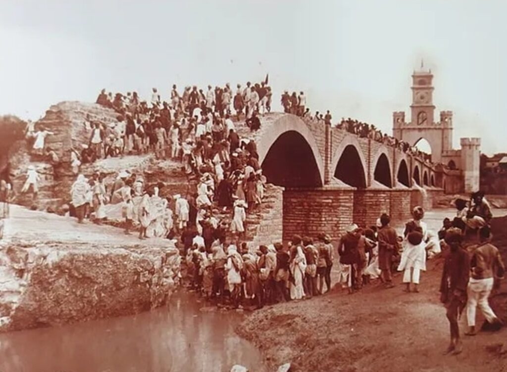
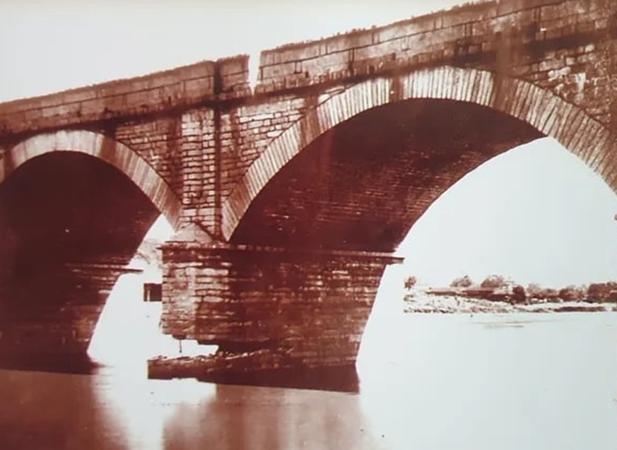
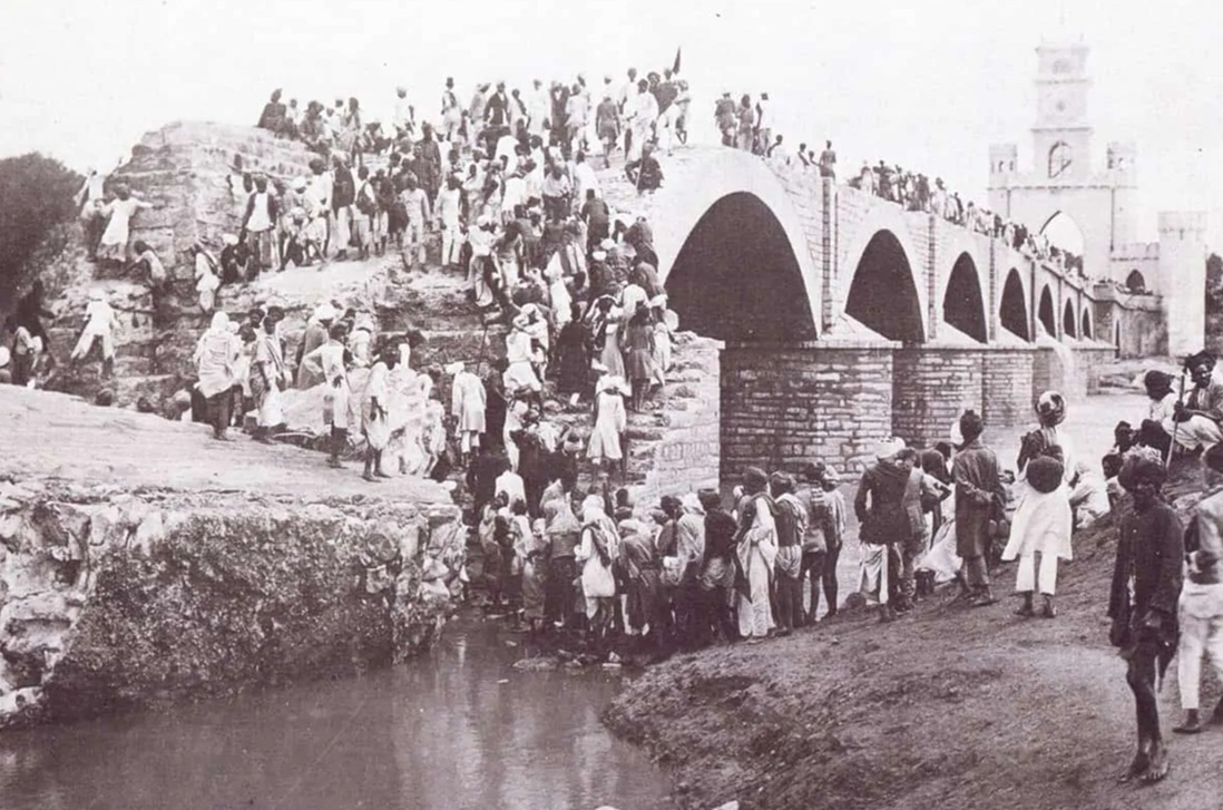
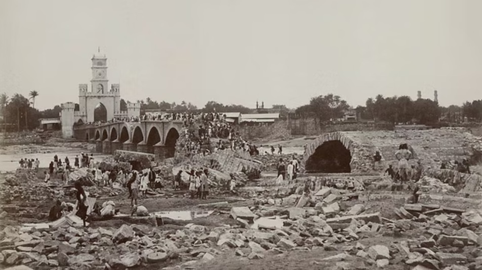
Around 15,000 lives were lost. Nearly 19,000 houses collapsed. Roughly one lakh people, a quarter of Hyderabad’s population then, were left without shelter. Three bridges were washed away completely: the Afzal, the Mussallam Jung, and the Chaderghat. Only Puranapul remained standing as the sole physical link between the two halves of the city.
One detail from such a tragic day has stayed in Hyderabad’s memory: 150 people survived by climbing a large tamarind tree on the south bank of the Musi. That tree still stands on the campus of Osmania General Hospital.
The sixth Nizam, Mahbub Ali Pasha, opened his palace to survivors, deployed elephants and horses for relief work, and contributed Rs. 5,00,000 from the State’s treasury, with another million raised through public contribution. While it was a significant response, it was also clear that rebuilding alone wasn’t enough and the city needed to be rethought.
Building around the river, not over it
Mahbub Ali Pasha called in M. Visvesvaraya, who was travelling in Italy at the time. Visvesvaraya arrived and took stock of what had happened, and why. His analysis was precise: the flooding had been catastrophic largely because 221 tanks in the basin had given way, sending a wall of water into the city all at once. The solution, as he saw it, was to build reservoirs large enough to hold floodwaters that exceeded the river’s natural capacity.
He joined as Special Consulting Engineer to the Hyderabad State government on April 15, 1909, and the work that followed was substantial.
Two storage reservoirs were built. Osman Sagar was constructed across the Musi and completed in 1920. Himayat Sagar was built across the Esi – the same stream that had been meeting the Musa near Bapu Ghat for centuries – and completed in 1927. The Musa and Esi now flowed through these reservoirs before entering the city, their waters regulated for the first time.
Redesigned riverfront for a safer, stronger city
But Visvesvaraya’s vision went further than water management. He pushed for a redesigned riverfront with stately public buildings and parks on both banks, where slums had previously crowded the riverbed. Residents were relocated to model colonies away from the floodplains. Flood level markers were placed on all major public buildings, both as a memorial to what had happened and as a practical guide for future city planning.
The southern riverbank within the old city was raised to 30 feet and lined with stone and cement. The cleared sites became parks. And on the edges of those parks rose the High Court, Osmania General Hospital, and the State Central Library – all of which defined Hyderabad’s civic identity for the next century.
By the 1920s, the Musi had taken on one more role it had never held before. It became the primary source of drinking water for the city. And from that moment, the relationship between Hyderabad and its river had shifted entirely. From a natural boundary and an occasional threat, the Musi had become an inherent, and inseparable, part of the city’s infrastructure.
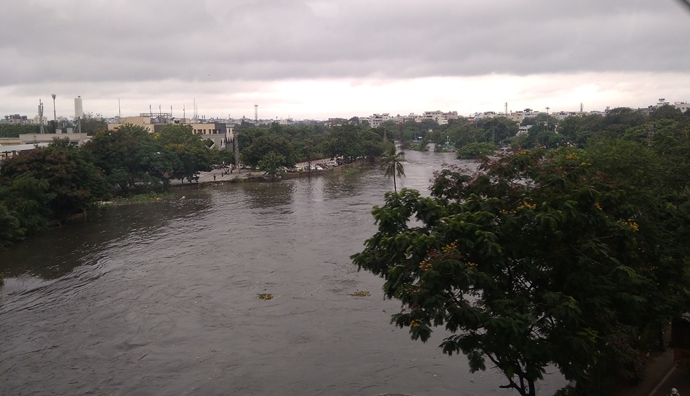
The river today: From lifeline to liability
From the Ananthagiri Hills to where it finally meets the Krishna River, the Musi runs close to 240 kilometres. Its most significant stretch, though, remains the one through Hyderabad.
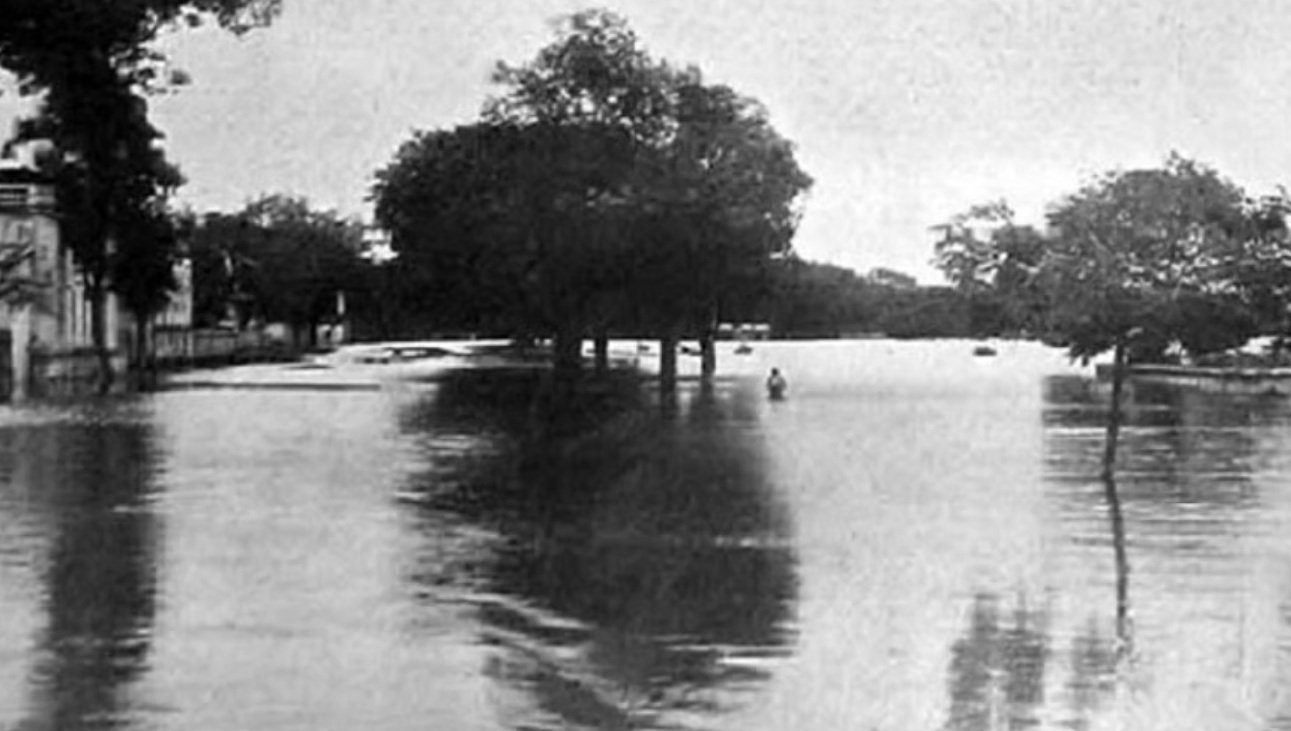
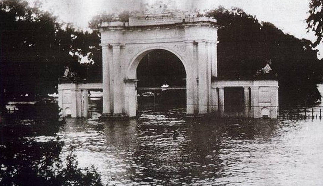
That stretch today tells a harder story. The Central Pollution Control Board (CPCB) has listed the Musi among the most polluted rivers in India. Slaughterhouse waste, domestic sewage, pharmaceutical effluents – all of it flows into the river. The dhobi ghat communities that once depended on the river for their livelihoods no longer use its water.
Older members remember when the water was clear, but that clarity is long gone. The reservoirs built to protect the city are now themselves under pressure, with encroachment spreading along their banks.
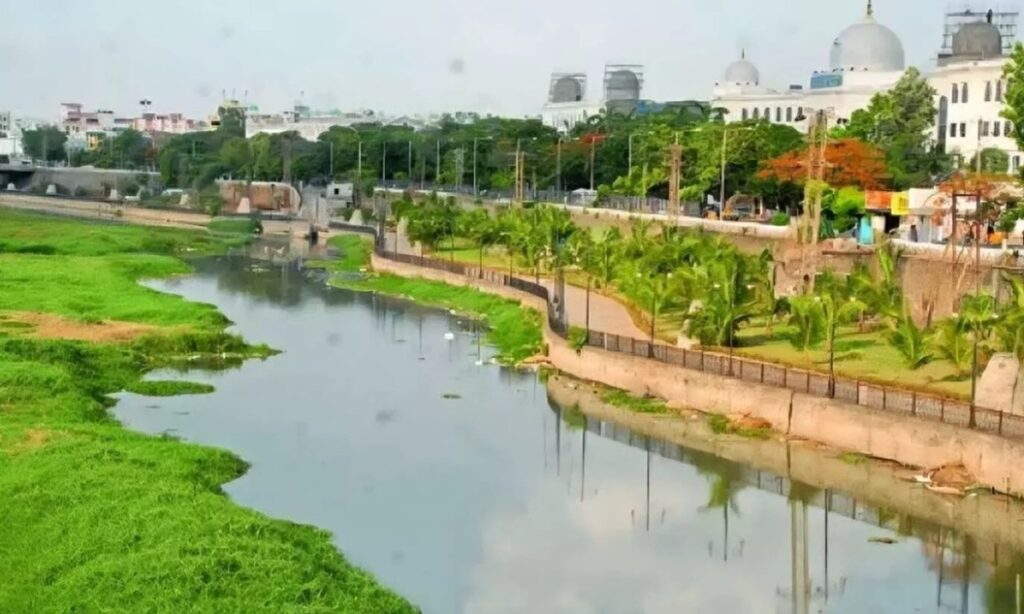
A city still shaped by its river’s edges
And yet, the river is still there. Stand near Bapu Ghat, where the Musa and Esi come together, and you can see the beginning of it all – two streams meeting, then moving on together through a city that was built around that confluence.
Hyderabad has changed enormously since 1591. But it is still, in many ways, living with the choices that were made along the banks of the Musi.